
Traditionally, Melbourne’s development has pushed out indiscriminately into the surrounding rural landscape. As a result, local ecologies have been compromised and natural systems disrupted. Tooradin is a village strategically located at the only place where the South Gippsland Highway meets the waters of Western Port. The Village is located 65 kilometres south east of central Melbourne. The Tooradin Village Strategy reverses this past development model and aims to actively rehabilitate the local ecology and promote sustainable development. The design philosophy is one of the local environment filtering through into Tooradin Village, instead of the Village pushing out endlessly. For example, the Strategy proposes a series of new linked wildlife corridors within the Village to help bring back Tooradin’s natural qualities and has also defined an ecological limit for expansion by creating strong regulatory edges.

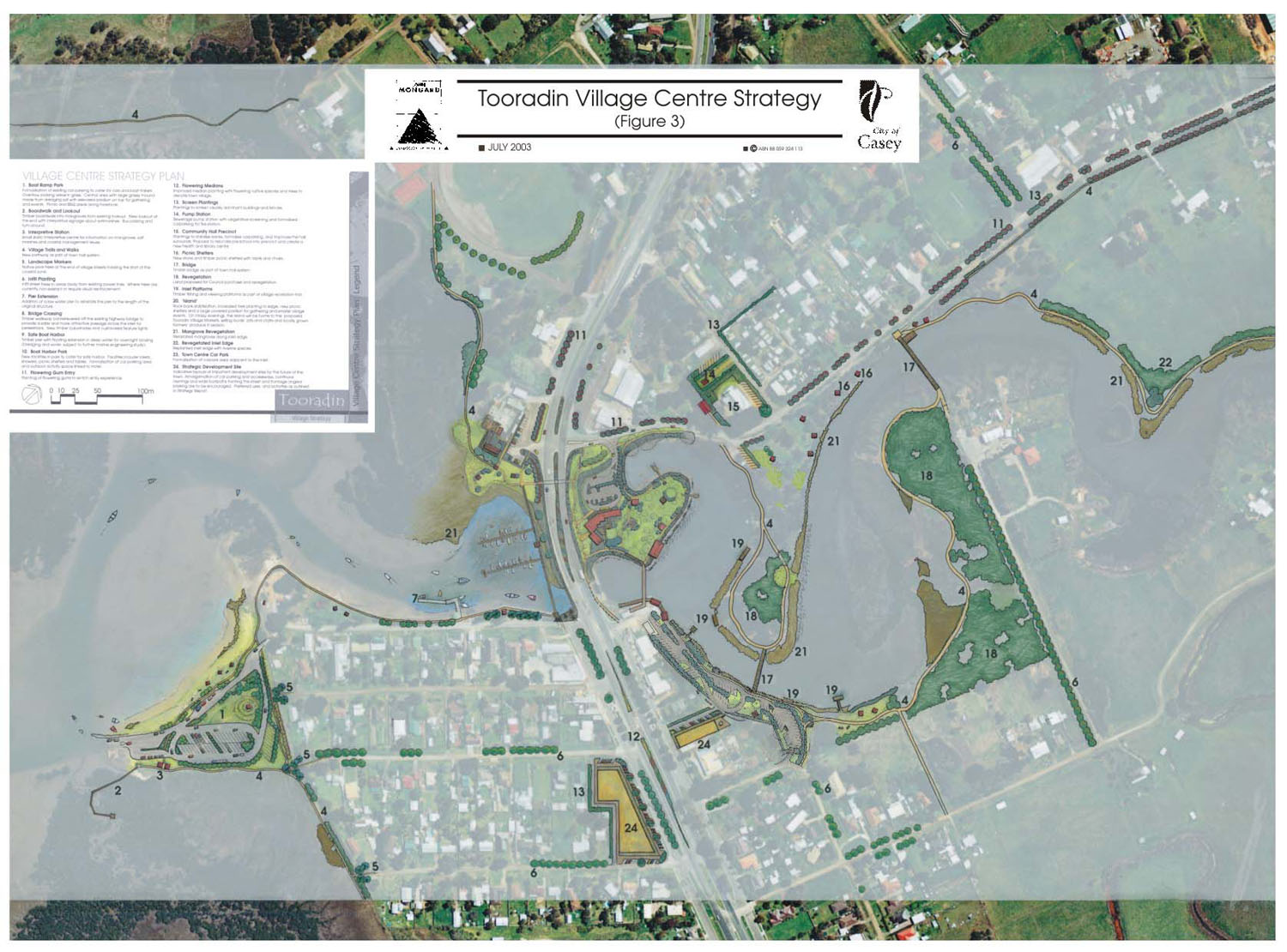
Tooradin Village Centre Strategy 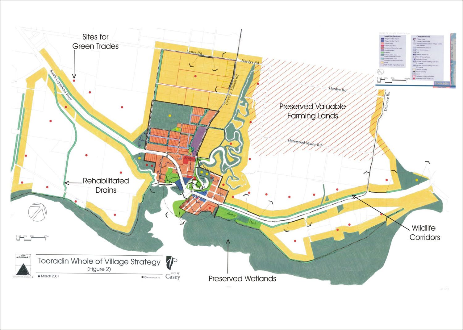
Priority given to the preservation of surrounding ecosystems
Green trades and RAMSAR Wetlands
Tooradin’s location on Western Port, with its internationally significant and precious natural features and habitats, ensures that the protection, maintenance and healing of the Tooradin’s natural systems will be a fundamental goal of the Strategy.
Tooradin is on the verge of a new wave of development pressure. The catalyst for this change has been the connection of the Village to reticulated sewerage, which will triple its population. The Strategy provides direction as to how new and infill housing growth can be best managed.
- The structure plan produced by JMLA is an innovative statutory and strategic planning mechanism which allows, amongst other things:
- Each vacant and infill lot to be assessed for its ecological footprint,
- Consolidation of lots and further density within walking distance of the centre as a trade off to limiting rural residential development on the periphery,
- Turning the village’s most important hill into a conservation reserve through a green trade,
- Establishing a population limit and growth boundaries for the village.
- Identifying land and corridor for environmental purchase, healing and conservation through green trades. Eg allowing additional houses in predetermined rural land in exchange say for valuable wetlands or wildlife corridors.
- Image 03: Tooradin Village Centre Masterplan
- Image 02: Set up Shop to gather ideas and feedback from the community
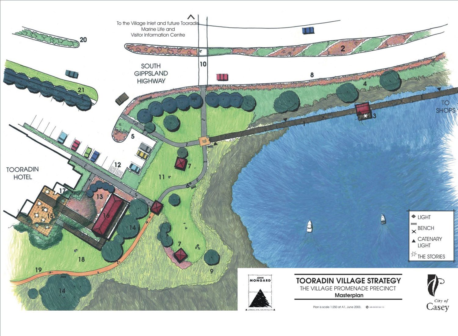
Tooradin Village Centre Masterplan 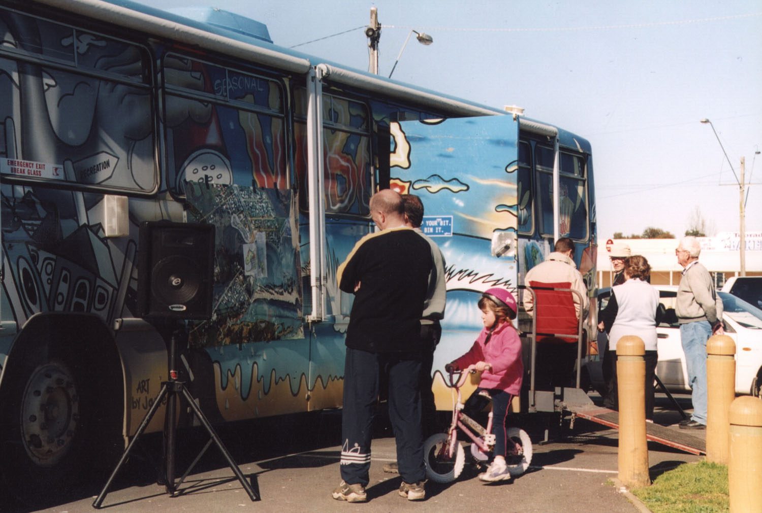
Set up Shop to gather ideas and feedback from the community
A Green Trade is considered by Council where there is a clear net community and environmental benefit and Green Credits are not limited to a particular property. This means that, a landowner in one part of Tooradin could re-vegetate a property, or hand-over to the crown valuable wetlands or turn a drainage channel into a wildlife corridor, in exchange for additional development rights in another location. The process has been actively working for 2½ years and has been well embraced by the local community.
The green trades system has yielded five conservation reserves to date and has already added hundreds of hectares of valuable environmental areas to the pool of the common landscape. This has been achieved smoothly and at no cost to council. The idea of Green Trades has the potential to revolutionize the planning process in Australia and is the first known process in Australia to be implemented in such a proactive community-led way.
The process being undertaken in Tooradin is holistic, comprehensive and culturally embedded. Strategic planning moves into design and construction through a long-term process which involves the community at each step. This type of place making accepts that cultural and community planning is a network, not a series of isolated events, constructions or projects.